


Sonya's Blog - Day 258 - The Grand Canyon
- Mar 6, 2016
- 4 min read
Sonya’s Blog - Day 258 - March 6th - The Grand Canyon
We are on the South Rim of the Grand Canyon. This is a good thing, because the North Rim is closed until the middle of May or so. The South Rim is the most visited area of the Grand Canyon. Four Million people a year visit the Grand Canyon and only 10% of those visitors go to the North Rim.
We are about 60 KM’s from the park entrance. Once we were in the park, we went to the Visitor’s Centre to park the truck and then walked along the South Rim Trail. It is paved and goes along the edge of the Grand Canyon. The Canyon is breathtaking. It looks surreal and in some of our pictures, it is like we are sitting in front of a green screen. It is hard to take in the scope of the Canyon, it is so huge. On average, it is 1 mile deep (1.6 KM’s), 10 miles wide and over 200 miles long. The park protects about 1/2 of the Grand Canyon. The North Rim is higher than the South Rim, which results in colder temperatures and more snow on that side. The South Rim tends to be drier and warmer. It was a bit chilly, as you can see from the pictures, when we arrived, but it soon warmed up.


We walked for quite awhile, from Mather Point to the Yavapai Museum of Geology. We then decided that we were hungry for lunch, so walked back to the truck (which is where we had left our packed lunch) to chow down. It was getting really windy by this time, so we just ate in the truck. We then decided to drive down to the Historic Grand Canyon Village and have a look around there. It is not so much a village, as a cluster of hotels. We saw the Kolb brothers art studio and shop, which cascades down the side of the canyon. The home was built in 1905, though the brothers arrived in 1902. The Kolb brothers were pioneering photographers and filmmakers of the Grand Canyon and they ran a successful photography business on the South Rim from 1903 to 1976.
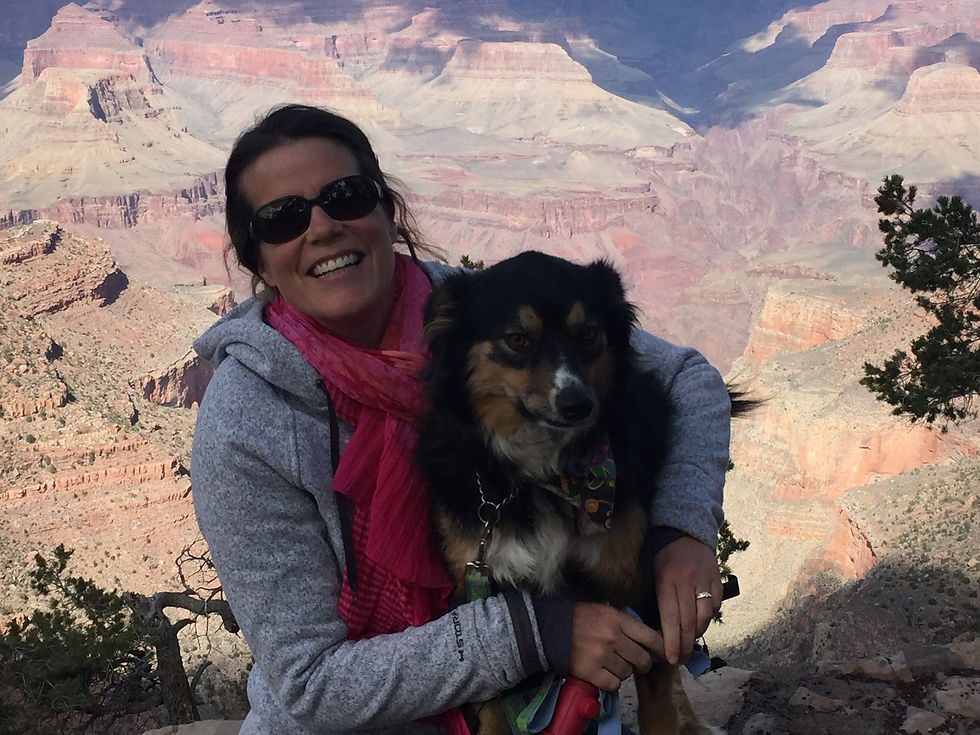
I am beside the Kolb Brother's Studio in this picture. Kizmet just jumped up on the wall to get a better look see:
The Bright Angel Trail, which goes to the bottom of the Grand Canyon is right beside the Kolb Studio. This will be the trail that we will hike, when we return.
We also went in the Bright Angel Lodge to have a look around. There was a small museum in the lodge that talked about it’s history. There was quite a bit about The Harvey Girls, who were waitresses that worked in restaurants for the Fred Harvey Company. He is credited with starting the first restaurant chain in the United States. He first contracted with The Atchison, Topeka & Santa Fe Railroad (AT&SF) to establish several eating houses at railroad stops in the late 1800’s. This was very successful and lead to several hotel-eating house establishments being set up along the tracks of the AT&SF railroads. There was a movie made about the Harvey Girls, starring Judy Garland.
The Bright Angel Lodge is behind me:

There were some nasty clouds coming in, so we went back to the truck and decided to drive to The Desert View. It was about a 20 mile drive along the canyon.
There are a lot of viewpoints along the road to Desert View, but we decided to go all the way to the end and then stop at some of the viewpoints on the way back. We did stop at the Tusayan Ruin and Museum, which was not on the canyon side. The Grand Canyon was on the left of us and the ruins were to the right. It is a small ancestral Puebloan village, it is estimated the population was no more than 30 people. The ruins are about 800 years old.

There is a massive stone tower at Desert View, that was built in the 1932.. The architectural work was done by Emily Colter, she was the architect for the Santa Fe Railroad, who commissioned the work. She bucked the trend of the generation and didn’t use European influences, but harked back to the history of the area and used Native influences. She did it in the style of the Kiva’s, which we have seen plenty of in the ancient Puebloan villages. Inside are different Native influences. There are 85 steps to get to the top of the tower, we all made the trek. When I went up, Blake stayed outside with Kizmet. I looked out the window, when I got to the top, and Kizmet and Blake were sitting on a bench below. Just then he looked up and we waved at each other, it was like a cosmic connection. Natasha had stolen my camera, so I couldn't snap a picture of them:(


From this lookout you could see the area of a 1956 airplane crash, where a TWA airplane and a United Airlines had a mid-air collision at 21,000 feet and then fell into the canyon. Pretty gruesome. There is a memorial plaque at the site. We could not see debris from the crash, you would need to hike down to the actual site to see that. This would involve backpacking in for about 2 or 3 days, just to get to the crash site.

It was getting really late, so we decided to start heading back. We stopped at Navajo Point for some pictures and a look around. We, also, stopped at some other look-outs before driving back.
View from Navajo Point:

View from Lipan Point:

When we got back we had supper, watched Get Smart and called it a night.
Sonya
Comments